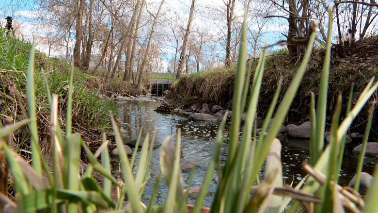
We have posted the report on the Riparian Restoration Bus Tour that Calgary River Valleys hosted on May 29th, 2015. To read the report, click here. There are some interesting pictures of the different projects at the 4 stops on the tour: root wads, willows, rip rap, and a crib wall. Have a look!
News
Riverbank Makeover Phase 1 “Garden Tour”
Posted by Admin in News | 0 comments
On August 22, 2019 we had a successful open house style tour of the riparian (riverbank) area on the Elbow River that we restored to fuller function in fall 2018. The wide variety of trees, shrubs, and wildflowers are doing very well & growing nicely since the spring this year.

Approximately 20 visitors dropped by to learn about the project, why we removed the Kentucky Bluegrass from part of this section of riverbank, and planted riparian plants there instead. We also discussed our plans for Phase 2 for this year, to replant another site on the Elbow River. For more information on this project, click here.
Phase 1 Riverbank Makeover Site
This site was chosen based on three main conditions: 1) the suitability of the riparian zone (low slope, area in need of more varied, deep-rooted vegetation, 2) willingness of the homeowner to participate, 3) accessibility of the site for monitoring over a 3 year period. See below for the "before" and "after" pictures & graphic of the design.


Fortunately the rain held off for most of the evening, but a downpour started about 20 minutes before we were due to pack up. Luckily we had our event tent set up to shelter the last 8 guests (and 3 dogs) from the rain until it tapered off to some degree.

Phase 2 Riverbank Makeover Site
The riparian restoration site for the Riverbank Makeover Phase 2 in 2019 has been selected and we have tentatively set a planting date for September 17. If you are interested in helping out as a volunteer gardener, please contact us as you would more than welcome to join us! Email us at: [email protected] for more details. See below for the current "before" condition of the Phase 2 site, and the planned layout for re-planting it in September this year.


Riverbank Makeover Phase 2 - 2019 Planting Design Legend
Big news! QB Court overturns City of Calgary Area Structure Plan
Posted by Admin in News | 0 comments
There was some big news in Calgary recently that you may not have heard about. In a decision published on February 22, 2019, the Court of Queen's Bench overturned the December 2015 approval of the Providence Area Structure Plan (ASP), since it did not include a Master Drainage Plan, a Staged Master Drainage Plan, or a description of the general location of the drainage patterns as was required in the Municipal Government Act (MGA), section 633(2)(a). That section of the MGA states that an ASP must describe the general location of public utilities (among other requirements), which includes the drainage (i.e. for moving streams, seeps, and storm water from the area). The judge ruled the approval of the ASP by City Council was therefore "patently unreasonable" and the judge has overturned the approval of the ASP.

What exactly is an Area Structure Plan you ask? It is a general, high level plan to outline the land uses for a large parcel of bare land generally at the current outskirts of Calgary that will contain multiple future neighbourhoods. It identifies the spots within those neighbourhoods that should be set aside for schools & community centres, major transportation corridors & connections to existing neighbourhoods, environmentally sensitive areas to be protected, other open spaces & pathways, major commercial activities, and the locations for residential developments of varying densities, etc. These high level plans, after approval by City Council, are then used by neighbourhood developers to build the neighbourhoods within the ASP with a more detailed plan for community layout, and using the Municipal Development Plan as a guide.

It should be noted that prior to the approval of the Providence ASP in December 2015, Calgary River Valleys sent a letter to Calgary Planning Commission, and another letter to City Council, to outline our concerns regarding the Providence ASP as was proposed. However, these concerns were not deemed to be of sufficient significance to alter the ASP as proposed. These concerns included (among others):
- A Master Drainage Plan should be submitted during the ASP preparation stage, but was not available
- Stormwater management -- that hydrological modelling was required to determine how to best manage the stormwater for the area,
- Wetlands -- that a geophysical & hydrological study was required to determine how these are contributing to recharge of the aquifer and how they are connected to the streams in the area,
- Environmental Open Space -- did not include the high value wetlands on the lands, or other environmentally sensitive areas that were identified, as we believed they should, and did not adequately accommodate wildlife movement to Fish Creek Provincial Park, which is close by.
Unfortunately, due the delay between filing for the judicial review in February 2016, and the decision being made in February 2019, many of the neighbourhoods within the Providence ASP are already nearing completion in the planning & development process. We believe this court decision will have an impact on the Water Act application by one of the developers (Qualico) to destroy all 24 of the wetlands on their site. It should be noted that another developer, slated to develop another neighbourhood within the Providence ASP boundaries (Dream Developments), hasn't yet applied for any Water Act approvals to destroy / alter the wetlands & watercourses on their parcel. We also believe this decision will have impacts on other ASPs that are currently in the process for approval by City Council, and should inform City Administration & Council regarding the risks of approving land use before the drainage issues in an area are known, including in the Highland Valley, with the approval in March 2017 for between 2000 and 4000 condos on the former Highland Golf Course lands.
It is not completely clear how the City and Province will proceed with the Providence ASP neighbourhood development applications, and how this court decision will affect other land use & planning decisions going forward, but we are working to find out more information.
Calgarians Dipped Their Toes in Some Citizen Science to Count Redds
Posted by Admin in Annual Trout Redd Count, Educational Opportunity, News, Opportunity for Public Input, Volunteer Opportunity | 0 comments
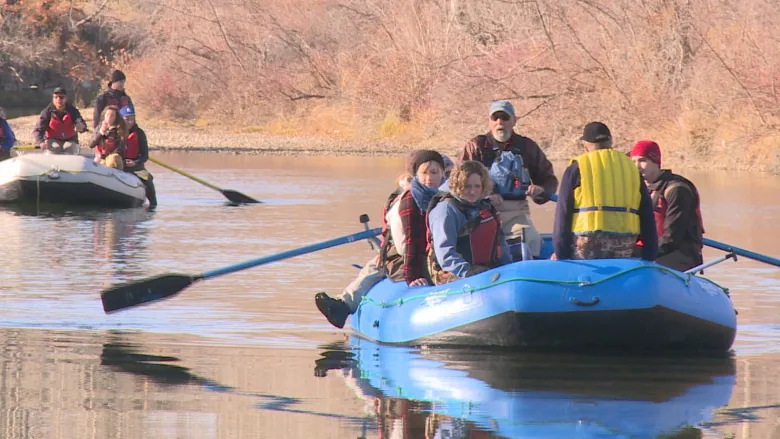
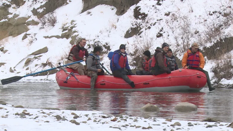
This November, Calgary River Valleys offered Calgarians two opportunities for citizen science, participating in our annual Brown Trout Redd Count in the Lower Elbow River, as well as a count in the Upper Elbow River for the first time. Both events involved counting and locating the spawning nests, also called “redds”, of Brown Trout, which required walking in the river to get visual confirmation of each redd. Funding support for this year’s counts was provided by City of Calgary Water Resources and the Land Stewardship Centre. On Friday November 9th, university students, members of the public, and environmental experts rafted and walked in the Lower Elbow River to count the number of Brown Trout spawning nests. This annual count, sponsored by Calgary River Valleys (CRV) since 2009, added to the data on the numbers and locations of Brown Trout redds in the Lower Elbow between the Glenmore Dam and Fort Calgary.

Lower Elbow: hunting for redds

Lower Elbow: spread out, looking for redds


Upper Elbow: Recording a redd

Upper Elbow: On thin ice

From Surprise Snowbank to Restored Riverbank
Posted by Admin in Educational Opportunity, Feedback Opportunity, News, Opportunity for Public Input, Projects, Riparian Restoration | 0 comments

Volunteers, including MLA Greg Clark, planting native vegetation on pilot project riparian restoration site on Elbow River

Project site before restoration

Final re-planted riverbank
Input to City Planning Decisions – Updated 2018-04
Posted by Admin in News | 0 comments
Calgary River Valleys has been very active recently in providing input to the City of Calgary's planning process for multiple projects. These are in various stages of the decision-making process. Highland Valley (former Highland Park golf course) At the City Council hearing on March 20, 2017, Council approved the land use change proposal for the Highland valley, with some minor changes made on the floor of Council to the municipal reserve (park) land allocated. This approval was made subject to the results from the pending Confederation Drainage study, which was investigating what was going to be required to address stormwater drainage for the Confederation Creek watershed, which covers a 17 square km section of north central Calgary, from Nose Hill to Nose Creek. In January 2018, the early findings of the Confederation Drainage study were presented in private to Council, but Council voted to release the PowerPoint slides showing the Highland Park valley (previously known as the North Hill coulee) was indeed the final drainage course for multiple streams, springs, and Confederation Creek, before it joins to Nose Creek, and these watercourses are considered Crown claimed. Current status: Calgary's Water Resources Department is negotiating with the landowner regarding options for managing stormwater on the Highland Valley site, as well as elsewhere within the Confederation Creek drainage area. City Administration will be preparing a written interim report by the end of May 2018 for presentation to Council and to the public regarding the recommended options for managing stormwater in the area. See below for more background on this land parcel & CRV's concerns expressed about developing it as was eventually approved.
City of Calgary Planning & Development Map
Posted by Admin in News, Opportunity for Public Input | 0 comments
The City of Calgary has created an online map of current Planning & Development applications that is available to the public. The information is provided by the City for anyone to research individual applications and participate in the development and planning process. The website shows Re-designation (or Re-zoning) Applications and Development Permit Applications. We have been advised that the City plans in the near future to also upload information about Subdivision Applications. To navigate the map, in the upper left hand side, you can search by (see graphic below):
- the application file number, if you know it,
- the address of the location
- the community or neighbourhood of the location
- the Ward of the location, or you can also just zoom in on a location on the map

City of Calgary’s 10-Year Biodiversity Strategic Plan
Posted by Admin in City of Calgary Biodiversity Plan, News | 0 comments
Biodiversity Strategy
The City of Calgary has now approved the proposed long-term biodiversity strategy. The BiodiverCity document outlines a vision for the future of an ecological network that is healthy, connected, and well-managed. The key indicator of success is proposed to be a 20% increase in naturalized open space by the year 2025.
Calgary River Valleys was a supporter of this strategy and provided input to City Council recommending it be approved. For more information, the BiodiverCity Strategy document is posted with a link below.
Click here (6.1 MB PDF) to download the BiodiverCity document.
See the Get Involved > Watershed Policy and Planning menu above for more information on other Planning issues that may be of interest to you.